www.crosshyou.info
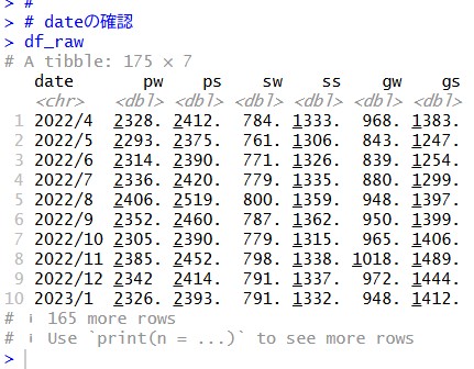
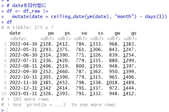
の続きです。今回は分析するためのデータフレームを少し加工します。
はじめに summary() 関数で、データフレームのサマリーをみてみます。
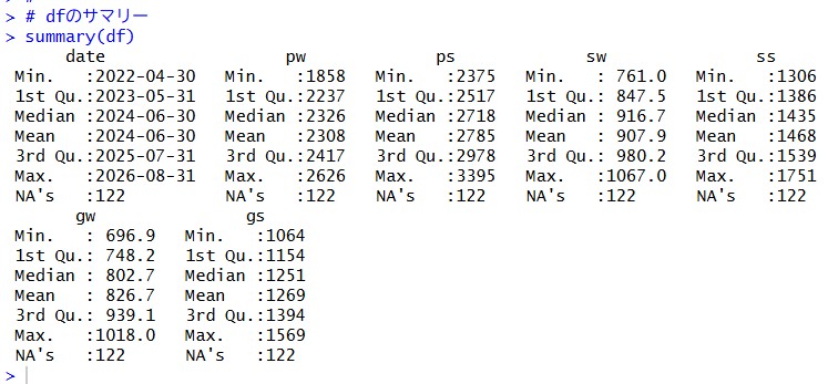
NA が122個もあります。na.omit() 関数で NA の行を削除します。
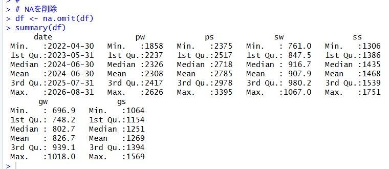
NA がなくなりました。データ期間は、2022年4月から2026年8月までの約4年間のデータです。
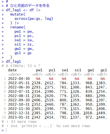
lag() 関数で1ヶ月ずらした変数をつくりましょう。
同じようにして、2ヶ月前の変数も作ります。
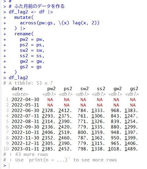
こうして作成した、df_lag1, df_lag2 のデータフレームを df と結合します。 inner_join() 関数を使います。
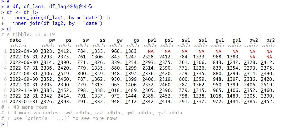
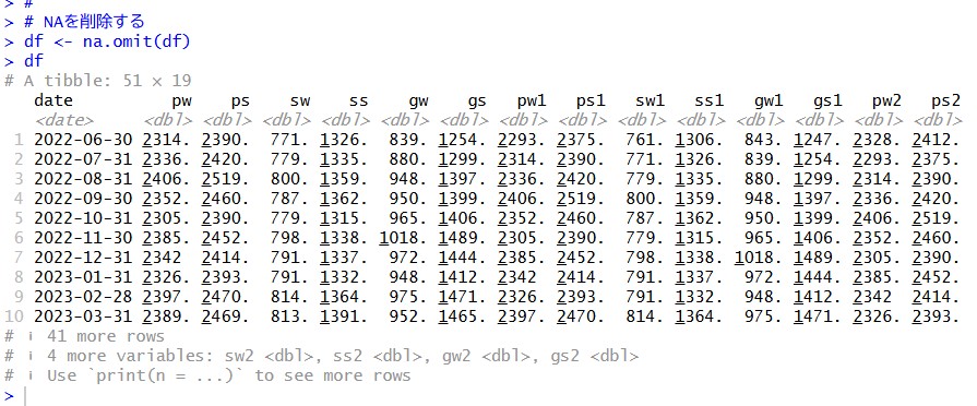
NA の行を削除します。
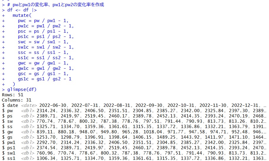
次は、pwとpw1, pw1とpw2の変化率を作ります。
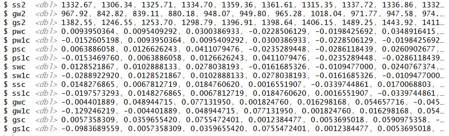
これで、とりあえずデータフレームの加工は終わりにします。
51行 X 31列 というかなり正方形に近いデータフレームですね。
私が調べたいのは、pw: プライム市場の加重平均株価 なのでこれのグラフを描いてみます。
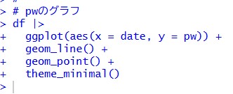
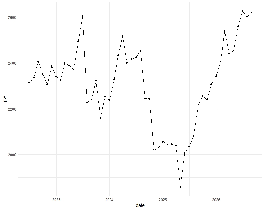
2025年の半ばまでは下落していて、そこから上昇に転じていますね。
変化率, pwc もグラフにしてみます。
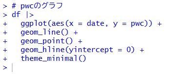
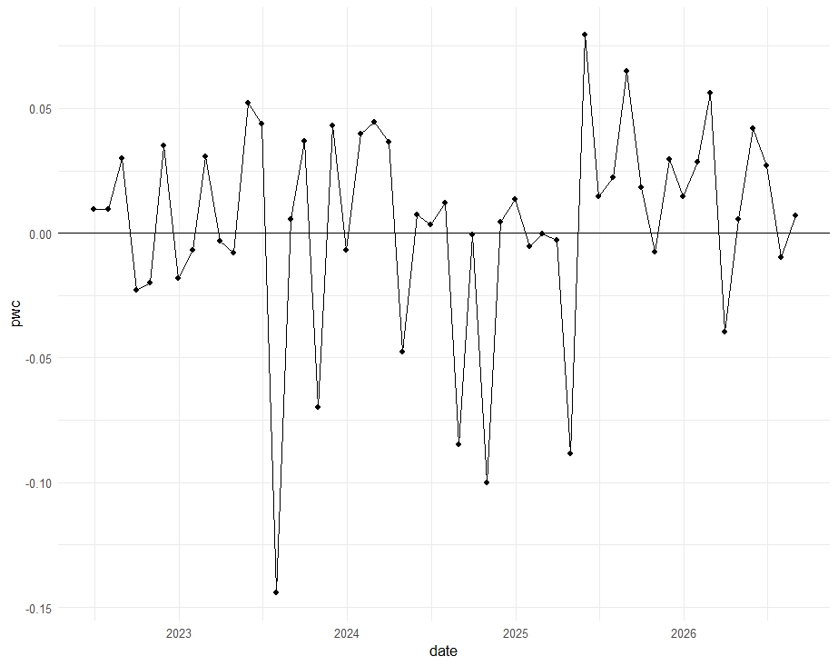
0 の水準に水平線を引きました。なんか、下落した翌月は上昇、上昇した翌月は下落、って感じですね。
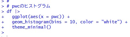
ヒストグラムも描いてみます。
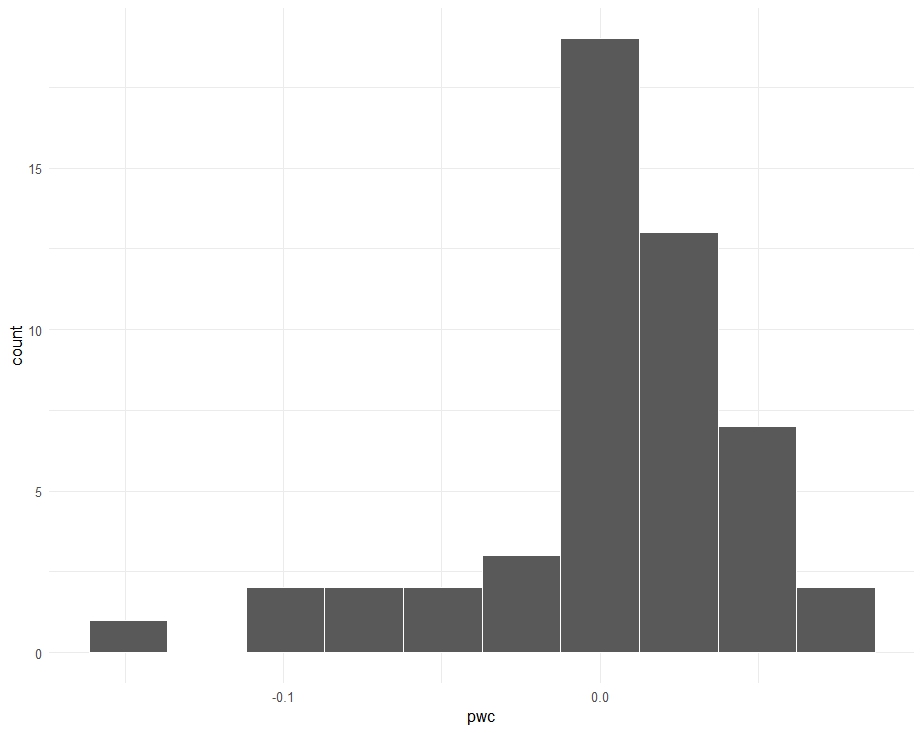
0 より大きいほうが分布は多いですが、大きな下落を経験していますね、-0.1 は、1ヶ月に 10% も下落したということですからね。
今回は以上です。
はじめから読むには、
www.crosshyou.info
です。
今回のコードは、以下になります。
#
# dfのサマリー
summary(df)
#
# NAを削除
df <- na.omit(df)
summary(df)
#
# ひと月前のデータを作る
df_lag1 <- df |>
mutate(
across(pw:gs, lag)
) |>
rename(
pw1 = pw,
ps1 = ps,
sw1 = sw,
ss1 = ss,
gw1 = gw,
gs1 = gs
)
df_lag1
#
# ふた月前のデータを作る
df_lag2 <- df |>
mutate(
across(pw:gs, \(x) lag(x, 2))
) |>
rename(
pw2 = pw,
ps2 = ps,
sw2 = sw,
ss2 = ss,
gw2 = gw,
gs2 = gs
)
df_lag2
#
# df, df_lag1, df_lag2を結合する
df <- df |>
inner_join(df_lag1, by = "date") |>
inner_join(df_lag2, by = "date")
df
#
# NAを削除する
df <- na.omit(df)
df
#
# pwとpw1の変化率、pw1とpw2の変化率を作成
df <- df |>
mutate(
pwc = pw / pw1 - 1,
pw1c = pw1 / pw2 - 1,
psc = ps / ps1 - 1,
ps1c = ps1 / ps2 - 1,
swc = sw / sw1 - 1,
sw1c = sw1 / sw2 - 1,
ssc = ss / ss1 - 1,
ss1c = ss1 / ss2 - 1,
gwc = gw / gw1 - 1,
gw1c = gw1 / gw2 - 1,
gsc = gs / gs1 - 1,
gs1c = gs1 / gs2 - 1
)
glimpse(df)
#
# pwのグラフ
df |>
ggplot(aes(x = date, y = pw)) +
geom_line() +
geom_point() +
theme_minimal()
#
# pwcのグラフ
df |>
ggplot(aes(x = date, y = pwc)) +
geom_line() +
geom_point() +
geom_hline(yintercept = 0) +
theme_minimal()
#
# pwcのヒストグラム
df |>
ggplot(aes(x = pwc)) +
geom_histogram(bins = 10, color = "white") +
theme_minimal()
#
(冒頭の画像は、Bing Image Creator で生成しました。プロンプトは、Clear fine photograph of nature green grass field. Under the blue sky and a few white clouds, some tiny colorful flowers are there. A close op of gold fragrant olive flowers. です。)